
Reviewed · MONTEREY, CARMEL & BIG SUR TOURS
Highway 1 Pacific Coast Highway Self-Guided Driving Tour Bundle
Highway 1 is a drive you remember.
This self-guided audio tour is built for exactly that kind of day: you get offline GPS and location-triggered narration that keeps your eyes on the road while the stories roll. You’ll follow the Pacific Coast Highway route from San Francisco toward Los Angeles, learning what you’re looking at as you pass it.
Two things I really like: you buy once and use the tour for a full year, and the price is set per group (up to 4 in your car), which makes it a strong value versus paying for separate guides. I also like that you can start when you want, pause for snacks or photos, and still keep the flow of the drive.
One drawback to consider: because it’s self-guided, you have to stay alert to the route cues. If you go off-course or let your phone audio get out of sync, you can miss the next story (and a few travelers have had app-start problems when the starting point wasn’t loaded correctly).
In This Review
- Key things to know before you go
- Highway 1 in Your Car, With Offline Stories That Don’t Need Signal
- Price and Time: Why $29.99 per Car Can Beat a Guided Tour
- Setup That Makes or Breaks the Day: Download, Start Point, and Sync
- From Pacifica to Santa Cruz: Bay Legends, Whales, and Quick Photo Wins
- Monterey to Big Sur: Sardines, Cannery Row, and the Bridges You’ll Photograph Twice
- Coast-Close to LA: Moonstone Walks, Butterflies, and the Finish at Santa Monica
- Should You Book the Highway 1 Audio Drive?
- FAQ
- How much does the Highway 1 Pacific Coast Highway self-guided audio tour cost?
- How long is the experience?
- Does the audio tour work offline?
- Do I need internet during the drive?
- What do I need to do to start?
- Where does the tour start and end?
- Are attraction tickets or park entries included?
- Is this a guided tour with a person meeting me?
- Can I pause and start later during the day?
- What is the cancellation window?
Key things to know before you go
- One purchase, one year: your ticket stays valid for the next 12 months
- Works offline after download: no cell signal needed once the tour is saved
- Audio plays by location: hands-free listening is the goal, but you still must follow the route and speed
- Designed for a long scenic day: plan around 10 to 11 hours, with essential coverage possible in about 5 to 7 if you keep moving
- No attraction tickets included: you’ll handle parking and any state park or site fees on your own
South down the coast, more of Monterey and Carmel
Highway 1 in Your Car, With Offline Stories That Don’t Need Signal
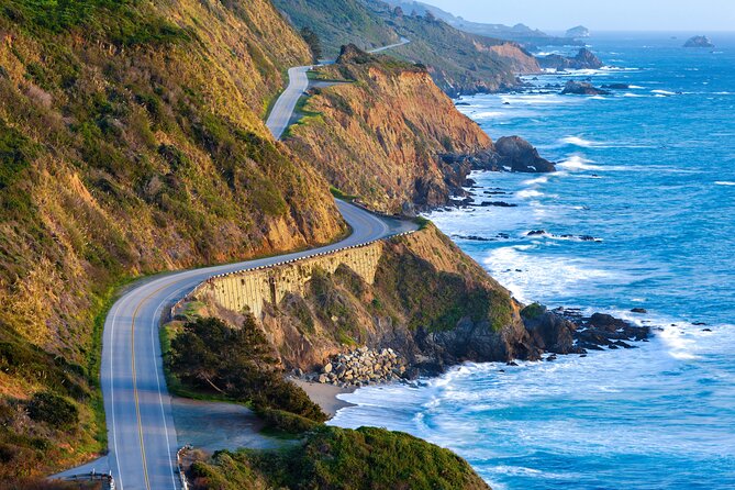
This is not a guided group tour with a live person. It’s a smartphone audio experience built around one of the best road trips in the US: Highway 1, also called the Pacific Coast Highway. The big win here is that the app is meant to run without relying on live internet. After you download, the GPS and narration keep working offline, so you can focus on views and pull-offs instead of worrying about coverage gaps.
The narration is also designed to make quick roadside stops feel more meaningful. You’re not just passing a name on a map. You’ll hear why Pacifica is tied to San Francisco Bay history and Spanish explorer Gaspar de Portolá, why Devil’s Slide has a World War II bunker story behind it, and why Gray Whale Cove can be a whale-watching stop in season. That kind of context helps you “see with your brain,” not just your eyes.
The other good thing: you control the pace. You’re not stuck with a rigid schedule. You can linger at viewpoints, do a short hike, or skip a stop if the timing is wrong. That flexibility matters a lot on Highway 1, where parking and weather can change your plan fast.
Price and Time: Why $29.99 per Car Can Beat a Guided Tour
The price is $29.99 per group (up to 4), and you’re booking the tour for a full day drive range of about 10 to 11 hours. If you’re splitting the cost across friends or family, it lands in the “easy yes” zone for a route this long and this scenic.
Here’s the practical math: a guided tour usually charges per person and can be expensive on a long drive. This one is per car, which is exactly what you want if you like traveling your own way. Also, the ticket is valid for a year. That means if you visit California again later, or you want to repeat parts of the drive, you’re not buying twice.
Two timing notes to keep you from feeling rushed:
- This tour is described as covering the essentials of Highway 1’s Pacific coast in about 5 to 7 hours, with a length of roughly 555 miles.
- The overall experience duration is listed as about 10 to 11 hours, which gives you room for breaks and sightseeing.
So plan on the longer side unless you’re truly a fast driver who only makes quick pull-offs.
Setup That Makes or Breaks the Day: Download, Start Point, and Sync
Start by treating the app download like a real step, not a casual tap. The instructions call out that you must download the tour while you’re on strong Wi-Fi or cellular, then it works offline afterward. If you try to download on weak service, you risk a frustrating start.
Next, begin at the designated start point. There is no staff member waiting there. You load the Action’s Tour Guide App, choose the correct tour version if needed, then enter the first story’s location so the audio starts automatically.
Two practical tricks from how this is set up:
- If you connect your phone to your car stereo, audio is easier to hear without constantly checking the screen.
- Keep to the suggested route and speed so the location-based narration stays in sync. When you change speed or drift off the intended path, the story timing can slip.
Finally, remember what’s included and what isn’t. The narration is included. Attraction entries, tickets, and reservations are not. Some stops are simple pull-offs, while others involve trails or state parks where you may need to handle your own fees.
From Pacifica to Santa Cruz: Bay Legends, Whales, and Quick Photo Wins
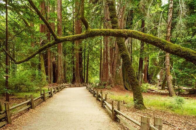
If your day starts in the San Francisco area, the northern stretch sets the tone with a mix of history, ocean views, and wildlife chances.
Pacifica is your first story stop, with details about Spanish explorer Gaspar de Portolá and how the Bay region ties into the broader history of the coastline.
Pedro Point is a rocky, high-payoff view spot, and it’s accessible only by footpath at low tide, so plan around tide timing if you want to go all the way.
Devil’s Slide Trail takes you to a World War II bunker built for lookout against a potential Japanese invasion. Today, it’s known more for local street art energy than military vigilance.
Gray Whale Cove State Beach is one of those “time of year matters” stops. During December and January, gray whales migrate south past the shore, and they can be visible with the naked eye.
Next, the route shifts into charming small-town coastline:
Montara is described as a rustic town with roots in an old lighthouse, and it keeps a classic feel with older buildings still around.
Half Moon Bay offers the scenic crescent-shaped bay vibe, but the narration also brings in darker history tied to mob activity and the area’s reputation in the past.
Bean Hollow State Beach is named for a coastline shape some people compare to a bean. It’s not trying to be flashy, just pleasant scenery and a good place to stretch.
If you like signature shoreline architecture, don’t skip:
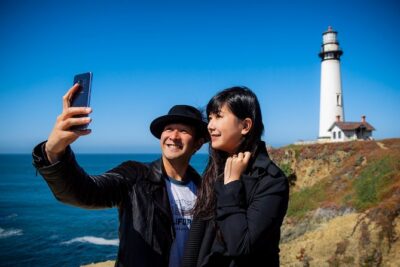
Pigeon Point Lighthouse is listed as 115 feet tall and described as the tallest lighthouse on the west coast and among the oldest. It’s also a strong photo stop.
As you continue, you’ll pass through major redwood country:
The tour includes spots where you pass lush redwood groves and then heads toward the area known for elephant seals, with the best viewing months listed as December through April.
Then comes small-town coastal character:
Davenport is tiny but known for pristine beaches and the Davenport Crack, where water has cut a deep tunnel through a cliff.
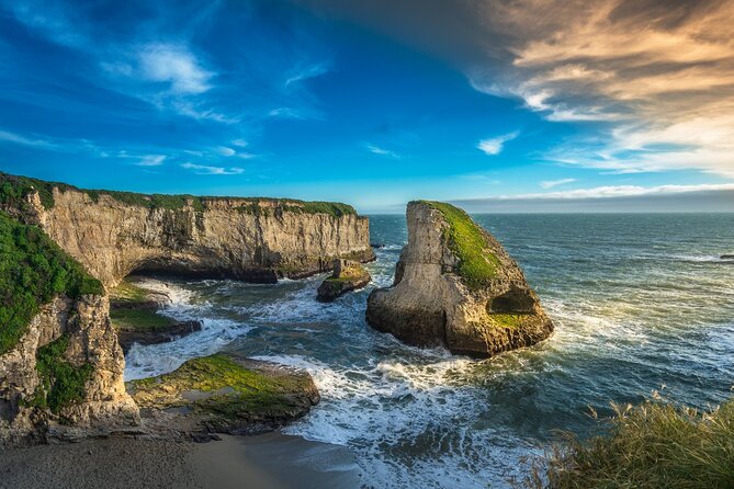
There’s also a stop for a cove named as if it has a shark fin, and a reminder that these are pocket beaches: smaller, more secluded, and usually a bit of scrambling to reach them.
In Santa Cruz, the audio leans into “classic California town” energy: founded in 1791, with quirky shops and good food.
For peak action, the Santa Cruz Wharf is highlighted as the main seafood hub, plus an amusement park with a functional wooden roller coaster.
Nearby, you can hear about the Mystery Spot from 1939, where you’ll experience demonstrations that appear to defy gravity.
And if you want a sunset-focused beach moment, Sunset State Beach is described as one of the best central California sunset spots, with crowds late in the day.
Wildlife and wetlands show up next:
Elkhorn Slough Reserve is described as a wetland where salt water meets fresh, with over 700 species of terrestrial and marine animals. Even if you don’t spot everything, the point is the biodiversity.
Then you’ll hear about the sardine population history in the coastal bay area before arriving at Monterey.
More days made simple with a local host

Monterey to Big Sur: Sardines, Cannery Row, and the Bridges You’ll Photograph Twice
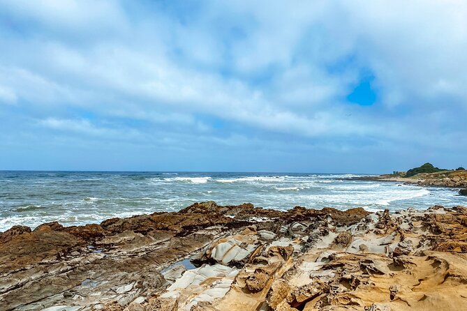
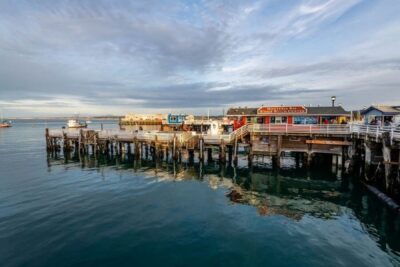
Monterey brings you back to the sardine-packing era. The narration notes Cannery Row as a converted-factory strip of shops and seafood, and it also calls out the Monterey Bay Aquarium as a major marine stop in the city. Even if you just pass by, the context helps you understand why the waterfront is so central here.
Then it’s time for the heavy hitters:
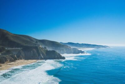
Big Sur is described as the iconic stretch of Highway 1 with dramatic bluffs over crashing waves, rugged hiking potential, and a remote feel.
There’s also a stop for the 17-Mile Drive detour through Pebble Beach and Pacific Grove, with lavish estates on one side and ocean views on the other.
In Carmel-by-the-Sea, the tone changes to a fairytale cottage vibe with lots of art galleries. The tour also points to a lovely white-sand beach beside a cypress grove, described as a local favorite for dogs and sunsets.
If you want “nature that feels protected,” the route includes a reserve stop near Carmel known for variety of marine and terrestrial animals, and it’s also noted as a scuba diving option for those who want ocean wildlife up close.
Next, Garrapata State Park is highlighted as having Big Sur hiking options, including trails that lead to the coast, plus inland routes through valleys and redwood groves.
Now for the architecture and geology you’ll actually remember:
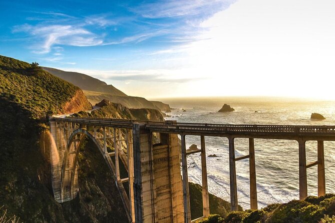
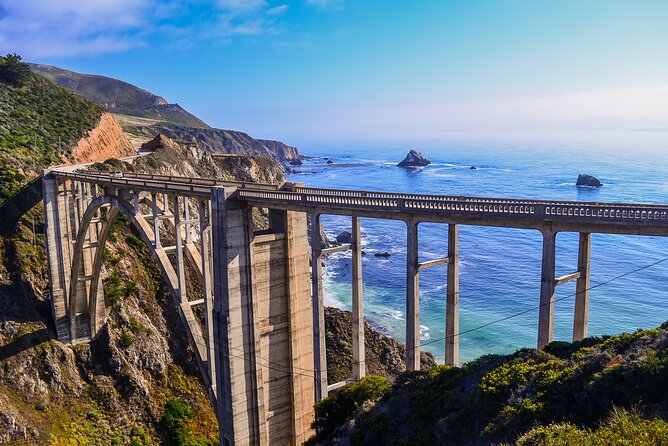
Bixby Creek Bridge is called out as one of the most photographed bridges in California, with a concrete arch and dramatic green bluffs plus ocean views.
You’ll also pass the Point Sur Lighthouse area, described as being placed on the National Register of Historic Places, tied to an island-like nightmare for ships at night that became a historic landmark.
The narration also makes a point about conservation: the area is described as unusually untouched due to earlier land owners forbidding development along that stretch.
Then come more iconic stops, in quick succession:
Pfeiffer Beach is famous for purple sand, with manganese garnet washing down from nearby bluffs.
You’ll also hit a viewpoint stop for one of Big Sur’s best views where you’ll want your camera ready.
Seal Beach Overlook is a seal-spotting stop, where you might see multiple seals lounging on the rocks.
For a sense of dramatic change:
Partington Cove is described as sheltered and secluded, with a rumor about Prohibition-era moonshiners using it as a dropoff point.
Another stop mentions an 80-foot waterfall that used to cascade directly into the Pacific, until mudslides changed the landscape.
Another standout bridge follows:
Big Creek Bridge is described as 589 feet long, with turnouts at each end to pull over and photograph.
If you like old industrial land and simple beauty, add:
Limekiln State Park with four 19th-century lime kilns.
Pitkins Curve Bridge gets a story-focused shout-out: a protective shed and bridge structure designed to safeguard the highway from rockslides.
And for geology-meets-story:
There’s a cove connected to a jade prospecting rush, plus a redwood grove stop where the tour notes trees that can grow up to about 350 feet.
As you keep moving, the route covers another Big Sur scenic stretch:
Ragged Point is described as one of the most picturesque areas, with minimal development and bluffs up to 400 feet above the ocean.
You’ll also pass a very popular rustic inn stop in Big Sur where even non-guests can grab a quick bite.
Then the tour hits an additional lighthouse-looking landmark, described as unusual because the top section was removed. After that, the audio turns wildlife again with Elephant Seal Vista Point, which is described as one of the best places for elephant seals, with a fully accessible walkway and a strong chance of seeing crowds of the animals.
Coast-Close to LA: Moonstone Walks, Butterflies, and the Finish at Santa Monica
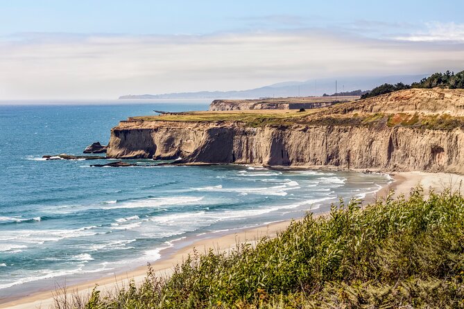
After the Big Sur focus, the route keeps shifting into smaller surprises and big-name scenery.
Moonstone Beach Drive is described as a scenic detour with a boardwalk for leg-stretching.
Nitt Witt Ridge is one of the strangest stops listed: an Arthur Beal house made almost entirely from trash, weird and somehow still beautiful.
Then you get contrast with tiny towns:
Harmony is noted as a town of only 18 people.
Cayucos is described as a small place with an old West feel, including saloons and antique shops.
Morro Bay highlights Morro Rock, a volcanic plug rising about 600 feet out of the water, and the narration notes it as a favorite nesting spot for peregrine falcons.
In San Luis Obispo, the audio adds the laid-back small-city vibe, plus Bubblegum Alley, where both walls have bubble gum left by visitors over the years.
You’ll also pass an area once tied to chromium and mercury mines that’s now over 8 miles of hiking and mountain biking trails.
Next, Avila Beach includes a dark-to-recovery storyline about an oil company obliterating the town and how it was rebuilt.
For a picnic stop with an odd name, Dinosaur Caves Park is described as having neither dinosaurs nor caves.
Pismo Beach is framed as one of the earliest landing places of European missionaries.
Seasonal wildlife follows: between October and February, around 25,000 monarch butterflies shelter in eucalyptus trees when you hit that butterfly grove stop.
In Guadalupe, you’ll hear about dunes that are among the tallest on the west coast, with some reaching up to about 500 feet.
Then the route includes Lompoc, famous for tens of thousands of flowers and murals across town, plus the Lompoc Wine Ghetto for tasting rooms and wineries.
If you prefer quieter beaches, the tour offers an optional detour to Jalama Beach, described as a crowd-averse alternative to busier shorelines.
Then it cycles back into more standard coastal pull-offs and beaches, including:
Refugio State Beach, described as a quintessential white-sand, palm-tree, shockingly blue-water California beach experience.
There’s also another butterfly grove stop where eucalyptus trees have been struggling, and therefore fewer butterflies are hosted than usual, with the best timeframe listed as November through February.
Then you reach Santa Barbara, described as one of California’s prettiest towns, with Spanish mission roots and a modern mix of restaurants, artists, and beaches.
A big vertical challenge awaits at Thousand Steps Beach, with only 218 steps to reach the beach and the reminder that you’ll climb them again.
More beach and surf shows up:
Carpinteria State Beach is called out for harbor seals.
Rincon Beach is noted as a top surfing destination and for hosting the Rincon Classic, with major surfing names tied to the event.
Faria Beach is another strong surfing option near Las Pitas Point, with limited sand space.
Next is Ventura, a San Buenaventura coastal city with restaurants and boutiques along the seaside boardwalk, plus a note about famous visitors like Johnny Cash and John Lennon.
You’ll also pass Point Mugu Rock, where early highway engineering had problems, and now it’s an easy pull-over photo moment.
For picnic practicality:
Sycamore Cove Beach is highlighted with picnic tables and grills for public use.
Then the route leans into rock-formation photography:
El Matador State Beach is described as defined by strange rock formations, and sunset is called the absolute best time here.
As you approach the Los Angeles coastline:
Point Dume and Zuma Beach are described as LA favorites for residents, with Zuma noted for long wide sands and surf.
Malibu is the classic SoCal beach town stop with laid-back vibes and major surfing opportunities, plus the narration points to celebrity homes.
You then end at Santa Monica Pier, a final “food and fun” focus with the beach and the pier at the center. The tour ends there, though the drive can naturally spill into more LA sights.
Two extra landmarks are mentioned on the way that are worth planning around if time allows:
- Getty Villa at the easterly end of the Malibu coast in Pacific Palisades.
- Hearst Castle in San Simeon, described as a National Historic Landmark and California Historical Landmark conceived by William Randolph Hearst and architect Julia Morgan, built between 1919 and 1947.
And if you want a quick context fact while you’re cruising: State Route 1 is described as the long north-south state route along most of the California Pacific coastline, at just over 656 miles.
Should You Book the Highway 1 Audio Drive?
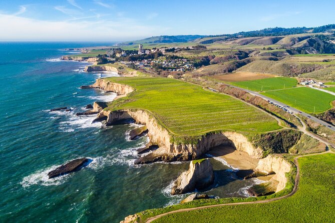
Book it if you want a low-cost way to understand what you’re seeing on a long, signature drive. The strongest reason is the offline, location-based storytelling that helps even quick pull-offs feel intentional. If you’re traveling in a group of up to four, the per-car price makes it easy to justify.
Skip it (or go in with extra caution) if you hate relying on your phone for route coordination. Because it’s self-guided, you need to stay on the intended path and keep audio timing synced by following the route and speed. Also, if you tend to skip setup steps, the required download on strong Wi-Fi/cellular can trip you up.
If you like freedom, roadside context, and a scenic drive plan you can adapt on the fly, this is a solid way to experience Highway 1 with less guessing and more meaning.
FAQ
How much does the Highway 1 Pacific Coast Highway self-guided audio tour cost?
It’s $29.99 per group, up to 4 people per purchase.
How long is the experience?
The duration is listed as about 10 to 11 hours.
Does the audio tour work offline?
Yes. Offline maps are included, and the app is designed to work without cellular or Wi‑Fi after you download.
Do I need internet during the drive?
You must download the tour while you are on strong Wi‑Fi or cellular. After that, it works offline.
What do I need to do to start?
You open the Action’s Tour Guide App once onsite, enter the password provided after booking, launch the correct tour version, and start at the designated starting point so the first story begins automatically.
Where does the tour start and end?
It starts near PG6H+8F San Francisco, and it ends at 108 Santa Monica Pier, Santa Monica, CA 90401.
Are attraction tickets or park entries included?
No. Attraction passes, entry tickets, or reservations are not included.
Is this a guided tour with a person meeting me?
No. It’s self-guided. No one meets you at the start.
Can I pause and start later during the day?
Yes. The tour is described as flexible: start anytime and pause anywhere for breaks and photos.
What is the cancellation window?
Free cancellation is available up to 24 hours in advance for a full refund; within 24 hours, the amount paid is not refunded.
More Tours in San Francisco
- Big Bus SF: Hop-on Hop-off Tour with 17 Stops and Sunset Option★ 4.0 · 4,539 reviews
- Napa and Sonoma Wine Country Full-Day Tour from San Francisco★ 4.5 · 4,455 reviews
- San Francisco: Hop-On Hop-Off Sightseeing Tour with 17 Stops★ 4.5 · 3,600 reviews
- Yosemite Highlights & Giant Sequoias Day Tour from San Francisco★ 4.5 · 3,455 reviews
- San Francisco Love Tour★ 5.0 · 2,830 reviews
- San Francisco: Alcatraz Island & 48-Hour Hop-On Hop-Off Tour★ 4.6 · 2,245 reviews
More Tour Reviews in San Francisco
- Muir Woods and Sausalito (Return by Bus or Ferry)★ 4.5 · 5,098 reviews
- Big Bus SF: Hop-on Hop-off Tour with 17 Stops and Sunset Option★ 4.0 · 4,539 reviews
- Napa and Sonoma Wine Country Full-Day Tour from San Francisco★ 4.5 · 4,455 reviews
- Small Group Yosemite and Giant Sequoias Day Trip from San Francisco★ 5.0 · 3,671 reviews
- San Francisco: Golden Gate Bay Cruise★ 4.7 · 3,644 reviews
- San Francisco: Hop-On Hop-Off Sightseeing Tour with 17 Stops★ 4.5 · 3,600 reviews
Down the Coast: Monterey and Carmel
- Monterey, Carmel and 17-Mile Drive: Full Day Tour from SF★ 4.0 · 2,187 reviews
- San Francisco: Monterey and Carmel Day Tour★ 4.3 · 110 reviews
- Monterey, Carmel and Pacific Coast Explorer from San Francisco★ 4.0 · 77 reviews
- From LA: SF, Yosemite, Santa Barbara and Carmel 3-Day Tour★ 4.4 · 72 reviews
- From San Francisco: Carmel, Monterey & Big Sur Private Tour★ 4.9 · 54 reviews
- Monterey, Carmel, 17 Mile Dr, Big Sur & Mcway Falls Pvt Tour★ 5.0 · 50 reviews
Just Reviewed: Fresh San Francisco Tours
- Private San Francisco City Tour + Alcatraz (Tickets Incl., Max 6)
★ 5.0 · 3 reviews - San Francisco: North Beach Food and History Walking Tour
★ 5.0 · 3 reviews - San Francisco Bay Cruise and City Combo Tour
★ 3.5 · 3 reviews - San Francisco City Half-Day Private Custom Tour
★ 5.0 · 3 reviews - San Francisco: Muir Woods, Point Reyes, and Meadery Tour
★ 4.2 · 3 reviews - Private Muir Woods and Sausalito Half Day Tour
★ 5.0 · 3 reviews
Monterey, Carmel & Big Sur Tours, compared.
 ★ 4.0Monterey, Carmel and 17-Mile Drive: Full Day Tour from SFFrom $1252,187 reviews
 ★ 4.3Monterey and Carmel Day TourFrom $134110 reviews
 ★ 4.0Monterey, Carmel and Pacific Coast Explorer from San FranciscoFrom $13477 reviews
 ★ 4.4From LA: SF, Yosemite, Santa Barbara and Carmel 3-Day Tour72 reviews
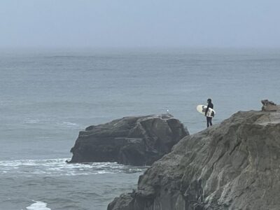 ★ 4.9From San Francisco: Carmel, Monterey & Big Sur Private TourFrom $92654 reviews
 ★ 5.0Monterey, Carmel, 17 Mile Dr, Big Sur & Mcway Falls Pvt TourFrom $89050 reviews
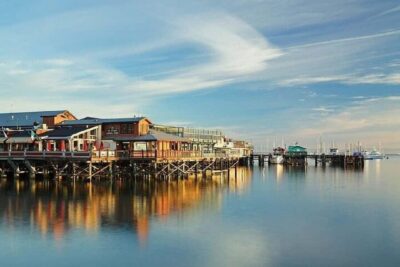 ★ 4.5Best of Monterey Peninsula & Carmel-the-Sea Small Group TourFrom $11843 reviews
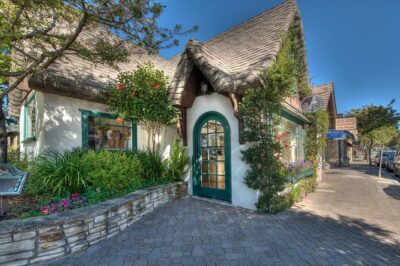 ★ 4.517-Mile Drive, Monterey Peninsula &Carmel Max 12 Small Group TourFrom $11830 reviews
Browse the lists this tour appears in